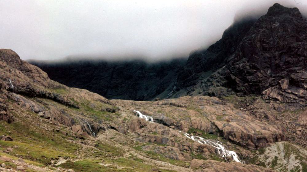
A mixture of mysticism, the moon, and Mordor greets the wanderer who sets out for Coir’ a’ Ghrunnda. The way there is not difficult – and yet leads into another world..

Coir’ a’ Ghrunnda can be thought of this way: Nestled in the Black Cuillins – the black mountains of Skye – is a valley depression open to the front. There, a small waterfall plunges into the depths. On the surrounding mountain range, which closes circularly around the depression, often clouds hang, so that one does not see their summit at all. This sometimes gives the impression of an “open mouth” that swallows the hiker.
If you climb up the rocks, you end up in a kind of moon crater, only sparsely covered with grass. In the middle of the crater, crystal clear water has gathered to form a loch, glowing a bright blue color. This is Loch Coir’ a’ Ghrunnda. There are boulders all around the loch, and a large rock juts out of the water.
Everything here oscillates between beautiful and eerie. A wonderful place …
Personal Note: My “Happy Place”
This enchanting place never left my mind. There was a cool, crisp breeze up there. The grey rocks, the craggy, jagged walls and the blue water are mesmerizing. Everything is clear and calm. Up here, the problems of the world are so far away and nature is so close.
At the same time, a beautiful view of green Highlands, the sea and the adjacent islands of Soay and Rum opens up from the bizarre mountain ensemble.
Coir’ a’ Ghrunnda is simply enormously beautiful and unique! Do I need some rest today, I close my eyes and I am there …
Unfortunately, I took few not so good photos due to excitement.
Knowledge: The highest hole of the Cuillins
Coir’ a’ Ghrunnda sits at just under 700 metres above sea level, making it the highest loch in the mountains of Skye. The surrounding peaks go up to almost 1,000 metres.
The name means “corry of the ground” – valley depression of the bottom.
Tip: Not for rank beginners, but not too hard either
You don’t have to be a crafty climber to get the nine kilometres and 700 metres of altitude behind you, even if there is a short passage of easy climbing at the end.
Basically, however, you should have some experience in hiking, put on suitable clothes and not start walking without maps. Because even if 700 metres are no altitude for hikers in Germany – in the Cuillins, one comes from normal zero (sea level) and has to reckon with the fast changing island climate.
Best to talk to the staff in the shop at Glenbrittle campground before you start and get tips and info on the tour and the weather.
Ascent route:
Up to the Coir’ a’ Ghrunnda it is simply only about 4.5 kilometers, but just 700 meters of altitude. The path is well visible. Nevertheless, you should better pack the OS Landranger Map “South Skye & Cuillin Hills”.
Starting point is the campsite at Glenbrittle. The path starts behind the toilet blocks. It leads first to Coire Lagan, then after about 45 minutes of walking you have to be careful to take the branching path away to the right. It goes around the Sron na Ciche, then the ascent takes place. Be careful to always stay to the left of the waterfall.
In order to finally reach the valley, the hiker has to complete a slight climb at the end of the tour before reaching the destination.
An overview map with the hiking trails marked is available hier.