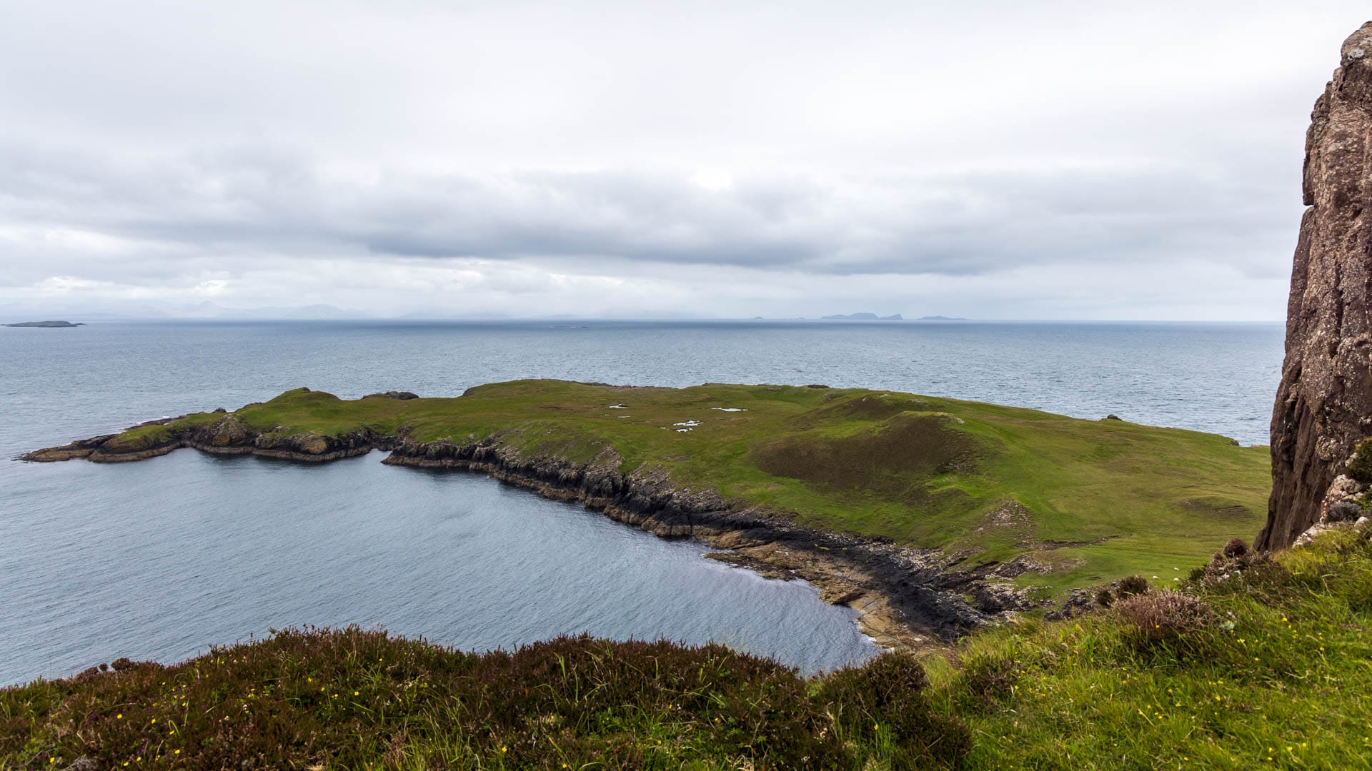
In the north, the Isle of Skye ends with a scenic highlight: Rubha Hunish is a headland at the end of a high cliff. The journey there is adventurous, but well worth it.
The Trotternish peninsula on the Isle of Skye is not short on scenic beauty: the Old Man of Storr, the Quiraing, the Kilt Rock – they show the art of which Scotland’s nature is capable. With the headland of Rubha Hunish, Trotternish comes to a fitting and impressive conclusion.
Rubha Hunish stretches like a tentacle towards the Isle of Harris in the north. The view to Scalpay is only obscured by the uninhabited island of Fladaigh Chùain.
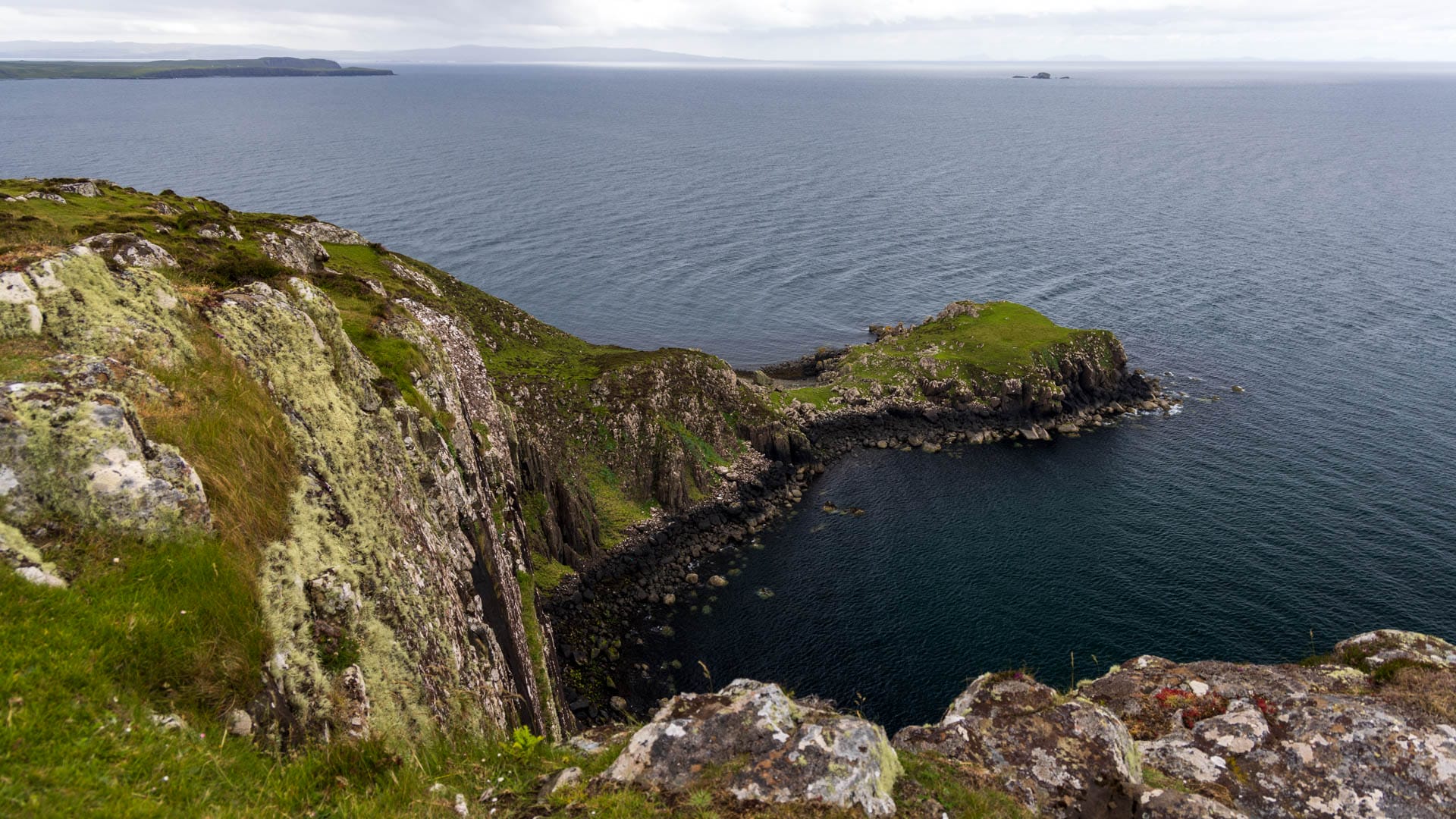
The headland of Rubha Hunish can be enjoyed perfectly from above. This is because it lies at the foot of a steep cliff that drops around 100 metres. But there is also a way down. If you take it, you will discover many more wonders.
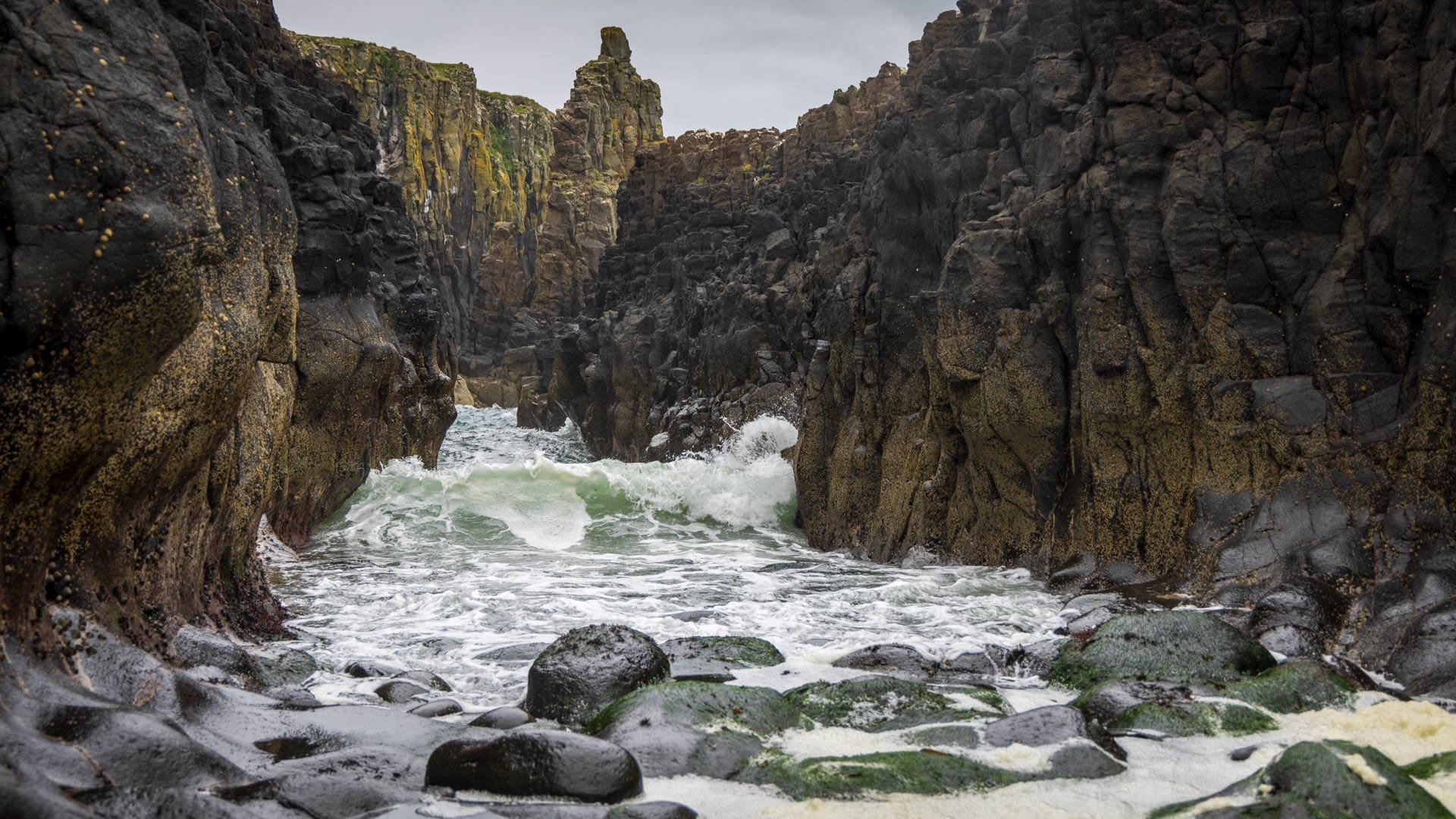
For example, the deep rock cuts into which the sea rolls.
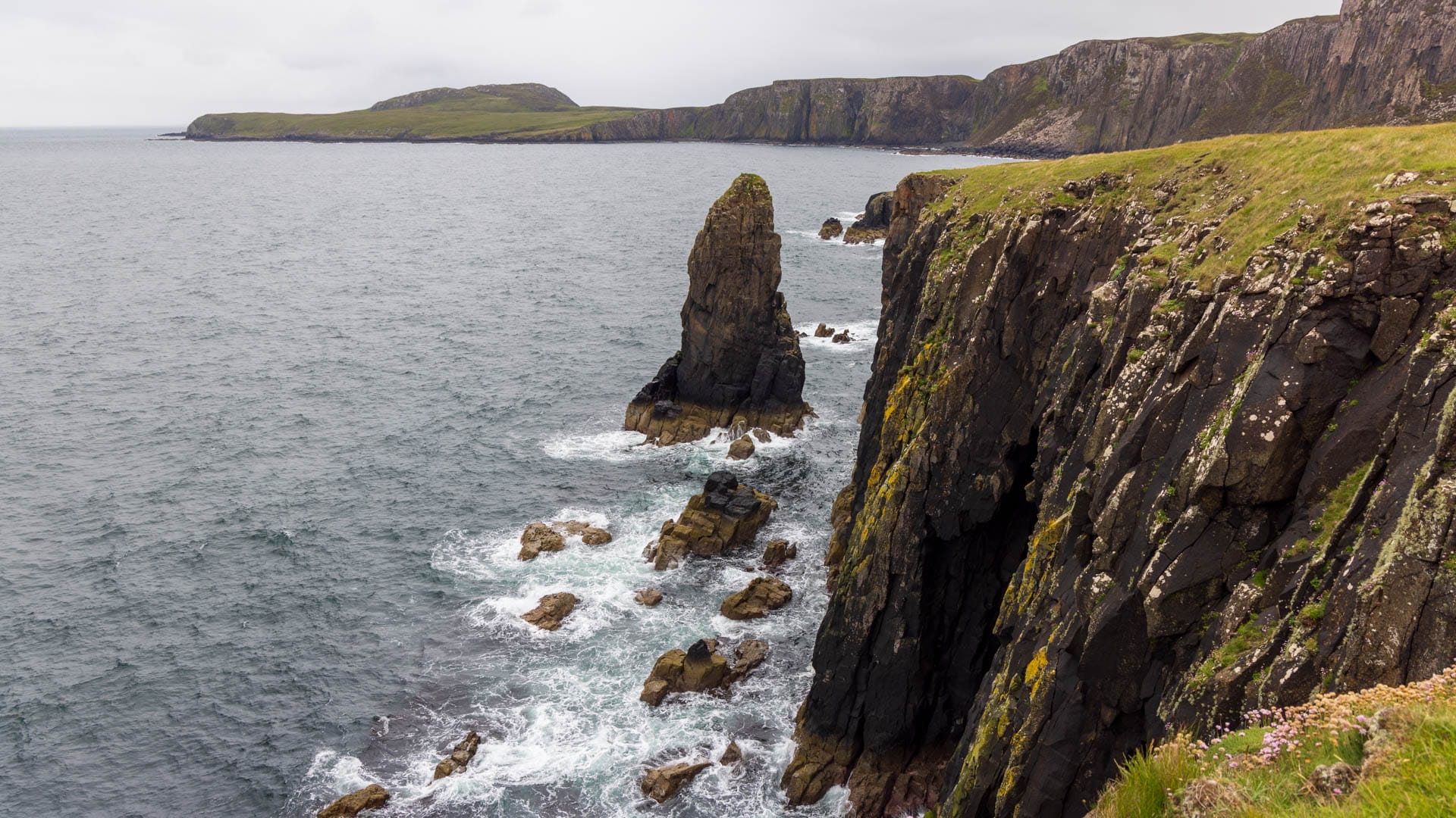
The many rock needles that rise out of the sea along the coast.
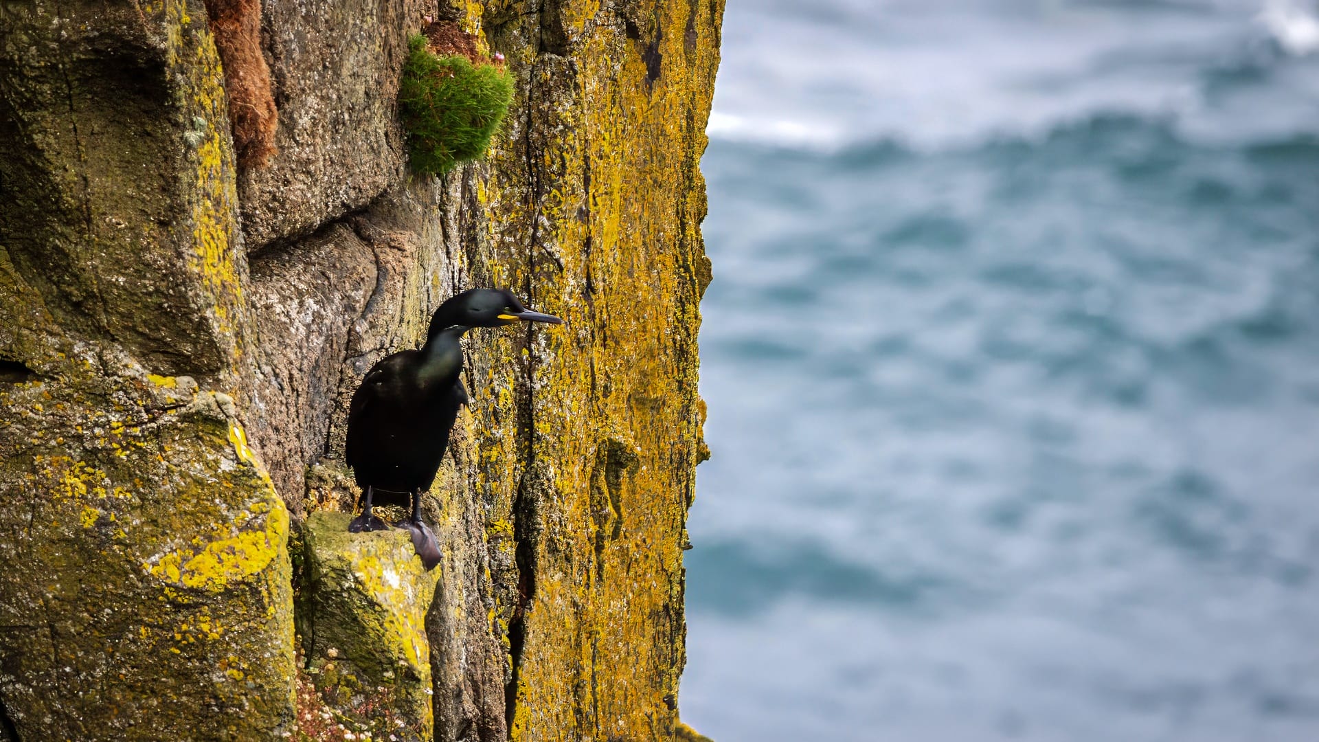
The birds that rest and nest in the cliffs.
However, there is only one way to experience all this: a steep, hundred-metre descent along a cliff.
Here are the directions.
Tour description: To the Rubha Hunish headland
Distance: approx. 10KM | Duration: approx. 4:30h | Difficulty: moderate (without descent), moderate (with descent)
The path to the cliff leads along a good path, but should not be used without suitable footwear. Before the cliff, two fences have to be climbed over on stepladders. The path down then also leads partly over smooth rock, on which it is better to move on all fours. However, the view of the descent also makes it seem a little more dangerous than it actually is.
If you opt for the circular route along the coast, the path can become very wet and strenuous at the end.
Here is a map of the route, followed by a description with pictures.
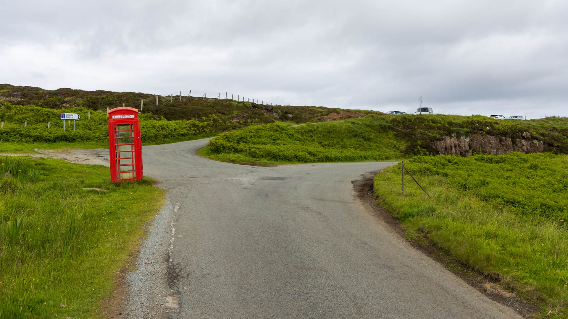
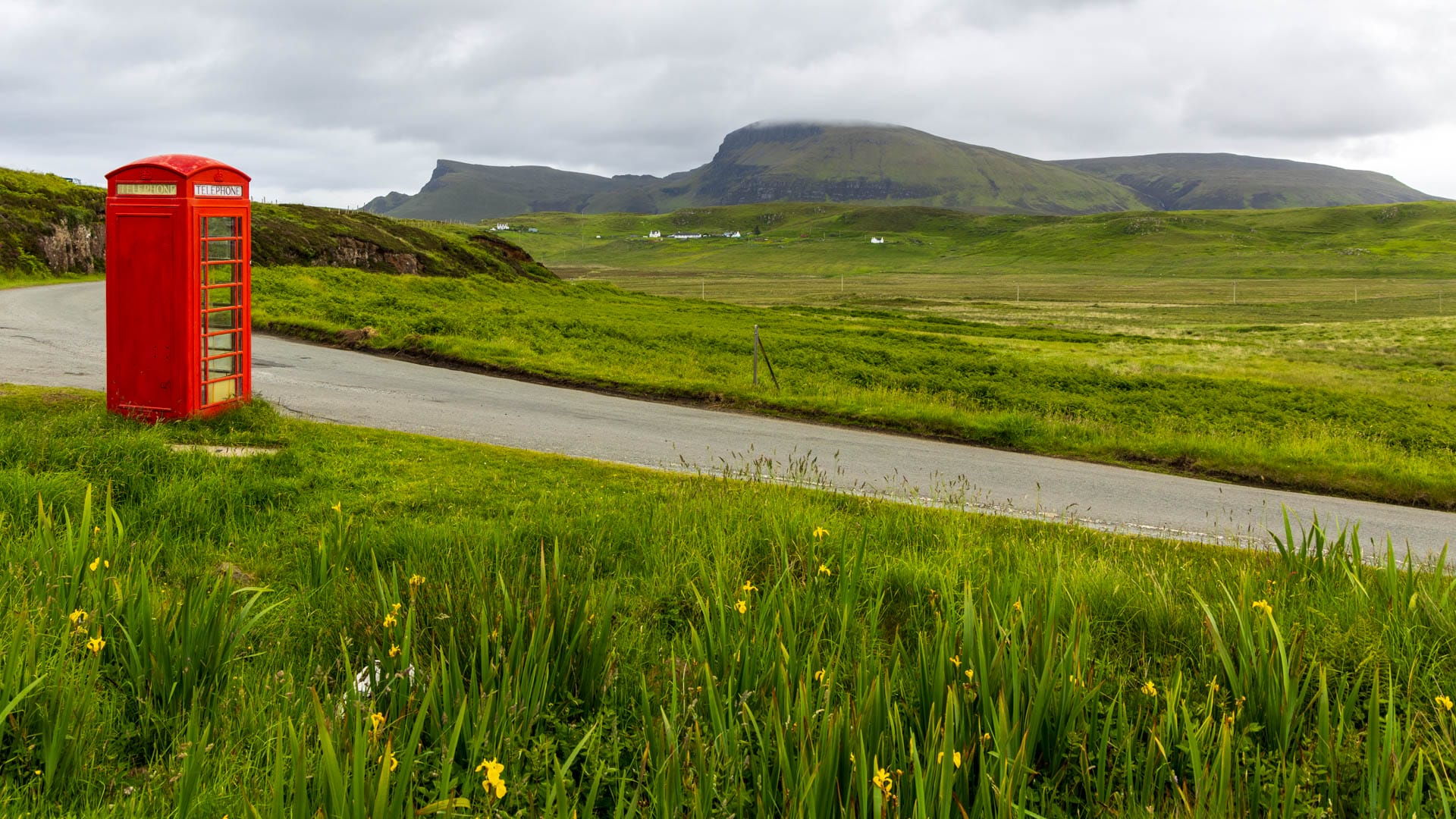
Start at the car park by the red telephone box in Sùlasda. From there it goes through a gate and immediately behind it left along the path.
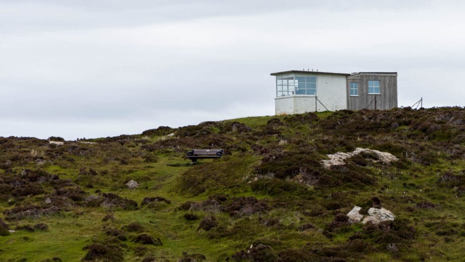
There is virtually no chance of getting lost here. The end is in a hollow. If you like, first go up to the right to the “Lookout”. This is an old hut that was built for the coastguard in 1928. Today you can rest here and enjoy the view over the cliff to the headland and the sea.
Return along the cliff, always following the fence, until you reach the hollow again. Here you now have to make a decision about the descent. The start already looks steep:
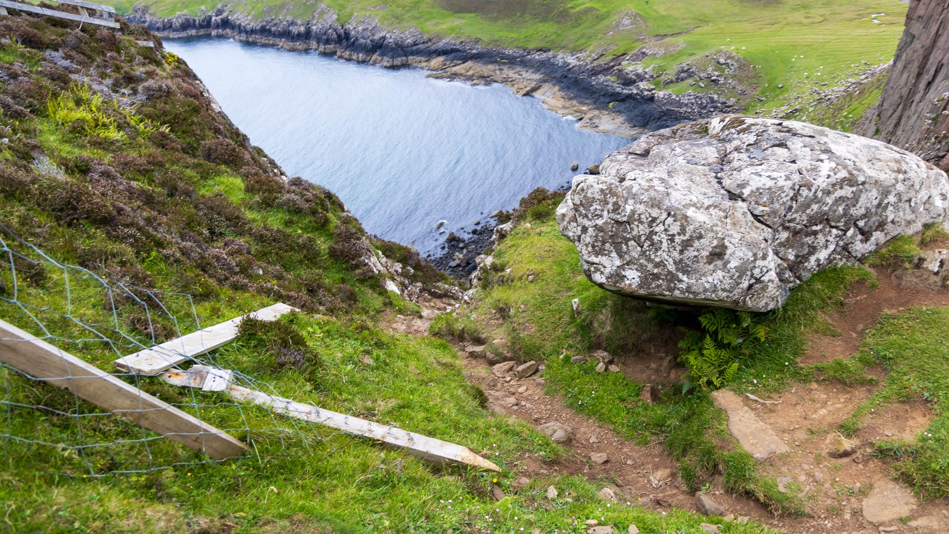
The start looks a little worse than the path is. Nevertheless, you shouldn’t be completely unfit. But after the start, the path becomes much safer.
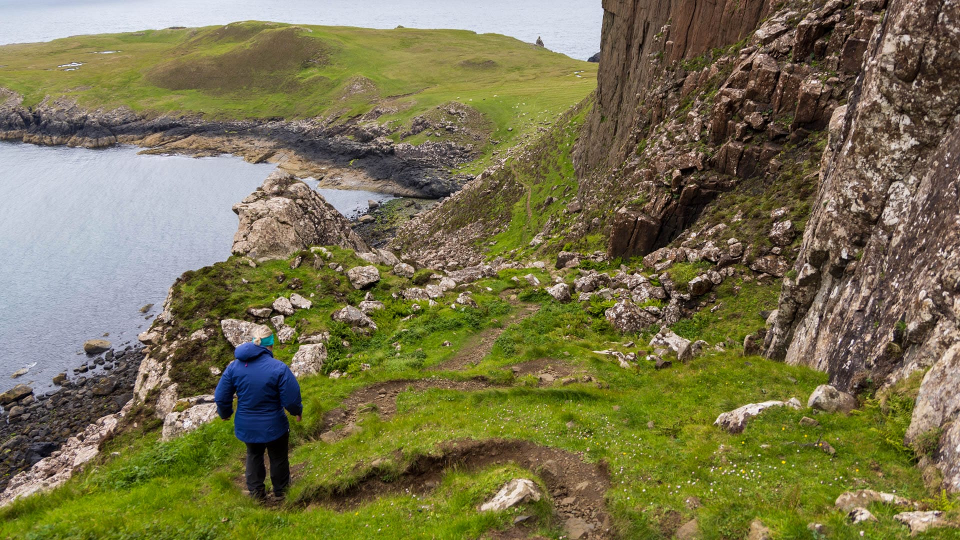
At the bottom of the peninsula, I recommend keeping to the right-hand side first and walking down to the rocky channel to see the waves rolling in. Then go round the headland anti-clockwise and then back up the path.
At the top, turn right or head west. Here a rough path continues along the cliff top.
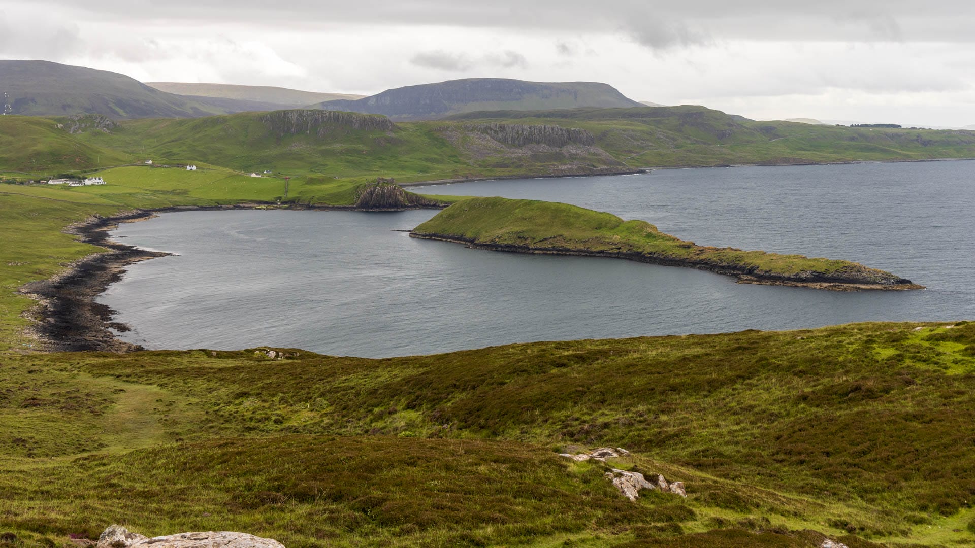
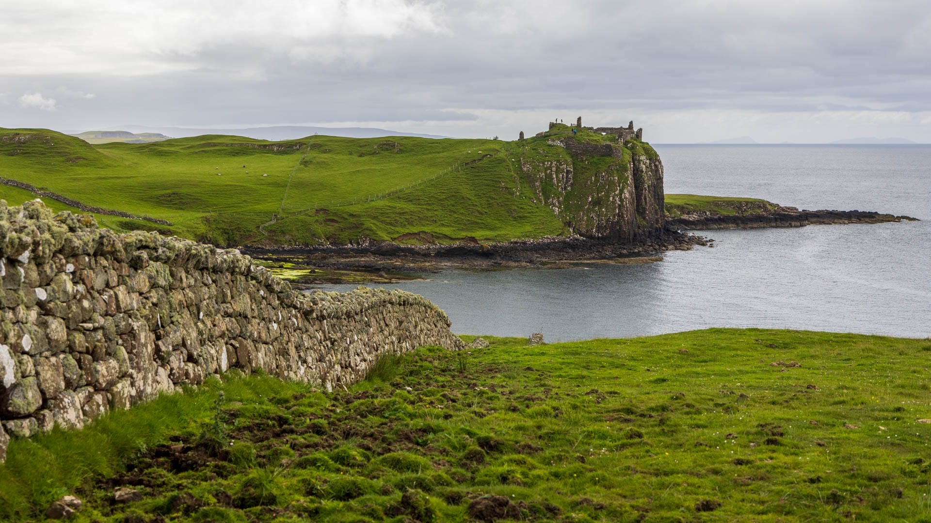
Head back south for a view of Loch Tulm with Tulm Island and Duntulm Castle at the end.
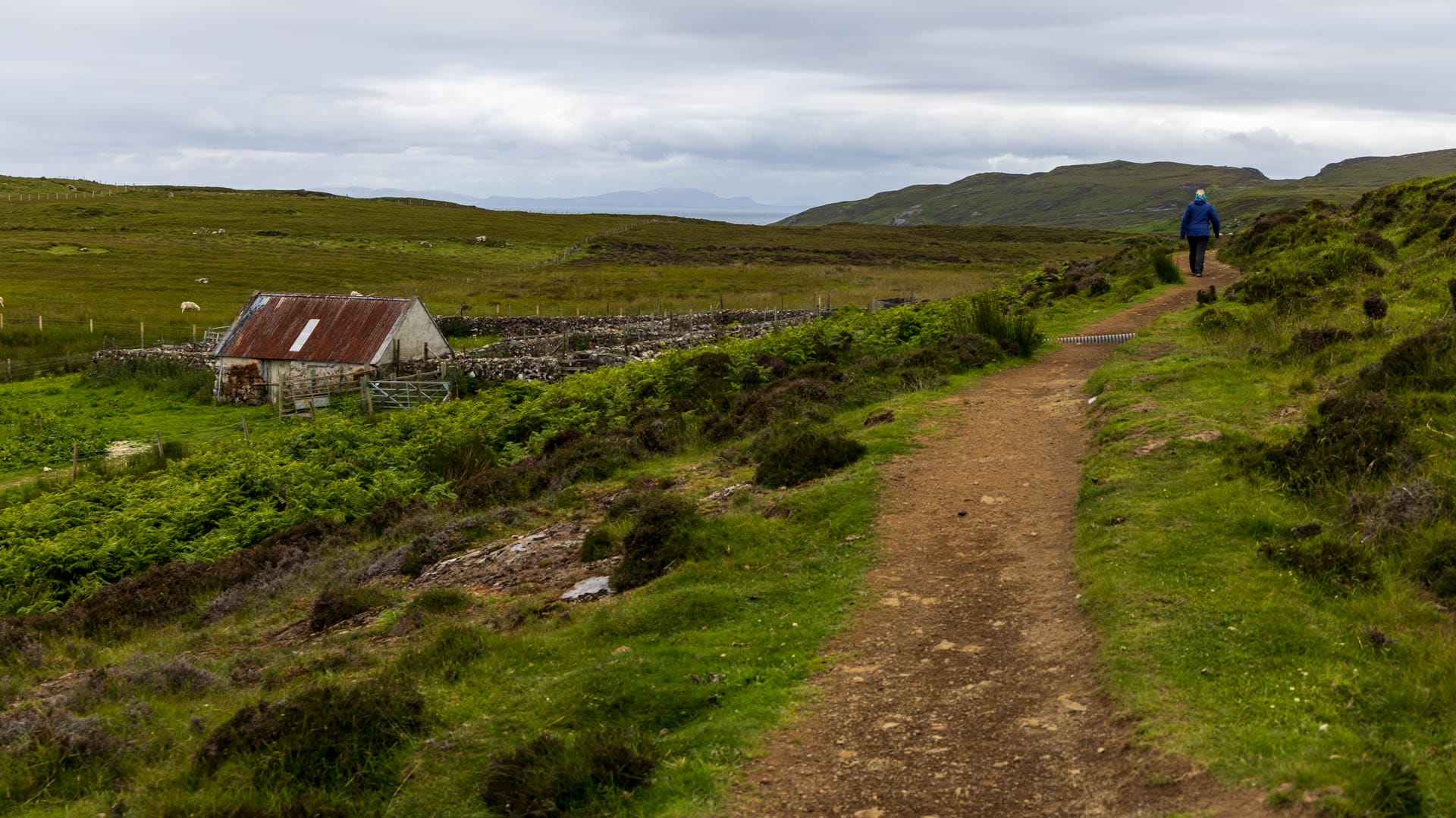
We descend along a grassy path. We enter the Erisco area. This fertile stretch of land was once so fertile that a settlement stood there and cereals and potatoes were grown. During the Highland Clearances, however, the landowners depopulated the area for sheep.
It now becomes more difficult to always make out a clear path. Depending on the weather of the previous days, it can also be very wet here. In any case, keep parallel to the coast. Every now and then, a seal likes to poke its head out of the water. At some point, the path reaches a wall, which we follow to the left.
The wall bends at the top, behind it a path leads to a gate. We now enter the grounds around the old Coastguard Cottages. Watch out for livestock here and work your way carefully towards the road.

Head back east along the road until the Sùlasda Phone Box and the car park reappear. This is the end of the walk.
Directions
With sat nav: “IV51 9UG” will take you to the area.
Without sat nav: Whichever side you take the road from, drive along the A855 on Trotternish until you see the red phone box to the north of the Quiraing massif. Here is a car park above the road.